


Best Navigation Apps for Your Road Trips
Jan. 6, 2022
Jan. 6, 2022
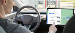
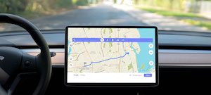
Whether you love taking road trips, enjoy going on Sunday cruises or have a poor sense of direction, it’s always good to have the right navigation apps installed on your phone.
Ever since GPS was invented, paper maps have given way to digital maps that show you where you are and how to get from point A to point B.
Are you looking for a new navigation app that works on iOS or Android? If so, we’ve got you covered!
Waze

Waze is the best app to use if you want to avoid getting in a traffic jam. This app gives you real-time driving directions based on live traffic updates and road conditions. It can also tell you which route to take to get to your destination faster.
You can even tell the app when you want to arrive at your destination, and it will let you know when you need to leave.
Additionally, you can save your route in Waze and the app will send you a notification when it’s time to leave. This advanced navigation app even lets you share gas prices from nearby gas stations with other users.
Like most navigation apps, Waze notifies you of closed roads and construction zones, as well as businesses and establishments along your route.
Pros:
- You can share gas prices with other users
- Waze offers several options for avoiding traffic and taking faster routes
Cons:
- When travelling to less populated areas, traffic information may be less accurate
- You must create an account to use the app
Google Maps
Google Maps is the most popular navigation app. It seamlessly integrates with the rest of the Google suite and allows you to save your favourite places and must-see destinations.
You can get directions and route information for driving, transit, biking and walking routes, as well as view them offline if you want to save your mobile data.
Google Maps also offers real-time traffic updates. Moreover, you can turn on the voice navigation feature, so you know exactly which turns and exits to take along your route.
The app is linked to Google’s other tools, so you can see Google My Business listings and what they look like through Google Street View. Google Maps works in both Apple CarPlay and Android cars.
Pros:
- You can access the app offline
- Google Maps provides you an estimated arrival time based on current traffic volumes
Cons:
- The app requires a lot of power and can drain your battery
- Google Maps often returns to the original route if you take a wrong turn, even if it’s possible to take faster routes
Maps.me
This app works a little differently than other navigation apps. You can easily find shops and driving routes. However, you must download a map of where you want to go onto your phone.
The map is downloaded to your smartphone so you can use it even when you’re in airplane mode. On top of being able to view the map, you can ask Maps.me to create routes for you.
It’s a great app if you don’t have access to data while on the road—if you download the maps beforehand. It also doesn’t use much power and won’t drain your battery.
Maps.me is also very precise and each pin belongs to a certain category. For example, in the entertainment section you can find casinos, theaters and more.
Pros:
- Maps.me works offline
- The app doesn’t drain your battery
Cons:
- You must download the map, so the app takes up memory on your phone
- Businesses aren’t updated very often
MapQuest
MapQuest is a Colorado-based company that’s been around for a long time. However, its digital shift began in 1996. The app can be used on your computer or smartphone.
If you like making several stops on your road trips, MapQuest is ideal because you can include up to 26 stops on your itinerary. This app is perfect if you want to fill your days with a variety of interesting pit stops in a city you aren’t familiar with.
In addition, MapQuest takes your preferences into account. For example, the app will suggest routes based on the roads you take most often.
You can also check traffic volumes, road conditions and traffic cameras along your way.
Pros:
- You can add up to 26 stops to your route
- The app suggests routes according to the roads you prefer or use most often
Cons:
- The app has ads
- Sometimes the mobile version of MapQuest isn’t very accurate
Apple Maps
As the name suggests, this navigation application is from the tech giant Apple. Apple Maps creates a 3D view of your route and offers directions if you’re travelling by car, on foot, via public transport, by bicycle or Uber.
The app also lets you save your favourite places and see the outside temperature and air quality of where you are and where you’re going
Pros:
- Apple Maps gives you a 3D view of directions
- You can see the outside temperature and air quality at your destination
Cons:
- You can only use Apple Maps if you’re connected to the internet
- The app only works on iOS devices (iPhone, iPad and Mac)
Note
The five apps in this article can be downloaded from the Google Play or Apple Store. However, Apple Maps only works on iOS (Apple). Moreover, they’re all free!
Which navigation app will you choose?